exactEarth to provide maritime big data monitoring for Ghana
exactEarth announced it has been selected by the Fisheries Commission, West Africa Regional Fisheries Programme, an agency of the Ministry of Fisheries and Aquaculture Development of the Government of Ghana, for the provision of Satellite AIS data services as well as a small vessel tracking solution. The contract value is in a range of CDN$1.0-$2.0 million for 12-month period and will enable Ghana to acquire the technology necessary to monitor its expansive coastlines and deter illegal fishing in its national waters.
Along with a comprehensive Satellite AIS data feed, exactEarth will provide MOFAD with 450 Class B AIS transceivers to be installed on inshore fishing vessels, which will be tracked via satellite utilising exactEarth’s exactTrax small vessel tracking technology.
In order to address the rampant illegal, unregulated and unreported fishing around Ghana’s Exclusive Economic Zone, MOFAD have provisioned this small vessel tracking solution to gain access to detailed fishing vessel positions and movement analysis services through the exactEarth ShipView platform.
exactEarth ShipView will be upgraded to include a SOS alerting facility in an effort to support Ghana’s government in their safety of life at sea initiative, which is intended to help its fishermen. exactEarth will be working with a local partner and academic institutions in Ghana to provide vessel movement analysis and reporting to help inform policy decision making and also to engage the next generation maritime professionals in coastal surveillance to protect and preserve Ghana`s fish stock for the future.
“This is an important strategic win and a major step forward for our small vessel tracking initiative,” said Peter Mabson, exactEarth CEO. “MOFAD needs a high performance, reliable and compliant maritime monitoring solution to protect their critical fishing industry and our small vessel tracking capabilities will be an integral part of helping them achieve that objective. This reflects the growing opportunity for both our large and small vessel tracking solutions and our reputation for having the leading Satellite AIS solution on the market.”
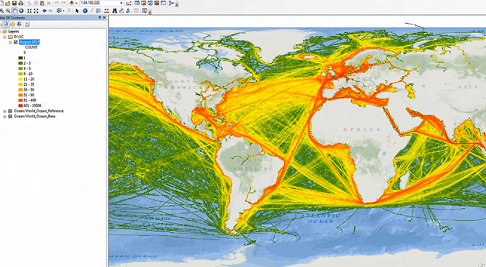
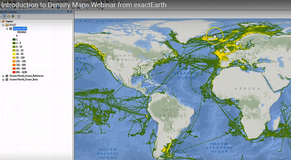
exactEarth is a provider of global maritime vessel data for ship tracking and maritime situational awareness solutions. Since its establishment in 2009, exactEarth has pioneered a powerful new method of maritime surveillance called Satellite-AIS and has delivered for its clients a view of maritime behavior across all regions of the world’s oceans unrestricted by terrestrial limitations.
exactEarth has deployed an operational data processing supply chain involving a constellation of satellites, receiving ground stations, patented decoding algorithms and advanced big data processing and distribution facilities. This ground-breaking system provides a comprehensive picture of the location of AIS equipped maritime vessels throughout the world and allows exactEarth to deliver data and information services characterized by high performance, reliability, security and simplicity to large international markets.
Click below to share this article
Signup to the Intelligent CIO Africa newsletter and never miss out on the latest news
A Lynchpin Media Brand